

© Avening Parish Council 2026
“Preserve, Conserve, Enhance”
Avening
Avening is a village dating back to the Saxon period. Located in a wooded valley two miles north of the town of Tetbury, in medieval times it grew around the church and later around the mills that were built for the wool industry. The Norman Church of the Holy Cross, consecrated in 1080, replaced an earlier Saxon church, and was built at the instigation of Queen Matilda, wife of William the Conqueror. Much of the present character of Avening originated in the 17th century with the development of the cloth mills and the cottage industries connected with them. The cloth industry was a major factor in the growth of Avening until well into the 19th century, giving it an industrial rather than agricultural outlook. Avening has a population of over 1000, making it the largest village in the South Cotswolds.

Avening Conservation
Statement 2008
Avening is a large, busy village whose character has been profoundly influenced by the exceptionally attractive valley in which it has developed. The village, which is typical of the Stroud Valleys' "cloth settlements", has grown along a complex network of roads and lanes that radiate outwards from the valley floor to climb the surrounding hillsides. The conservation area comprises the two older parts of Avening, including the landscape setting of certain parts of the village.

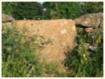
Avening Defence Line
Survey 2012
An HER project focusing on a section of the GHQ Line Green defence around Avening, including the tank ditch and ‘pill boxes’. The GHQ lines were static linear defences constructed under General Ironside in preparation for the expected German invasion. These lines were constructed in June 1940 but by the beginning of 1941 they were no longer regarded as being of value and large lengths fell into disuse. Written by Emma Slater MA.

Holy Cross Church -
Standing Report 2012
This Standing Building Report was produced for the main assessments of the Standing Building until as part of the Landscape Archaeology Masters at Bristol University. This report presents the results of a detailed survey of the 12th Century Holy Cross church, Avening. It is elaborating on a previous study of the Church which was produced in 2008 by Emma Slater MA. Sections of this report are currently being used on the Holy Cross website.


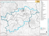
Parish Boundary Maps
Current and historic maps showing the Avening Parish boundary. (C) All rights reserved
Parish boundary map
Historic map


Post code map of Avening
If you need to find your way around the village, this handy post code map will help.


Listed buildings
If you need to find your way around the village, this handy post code map will help.
List view
Map view

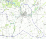
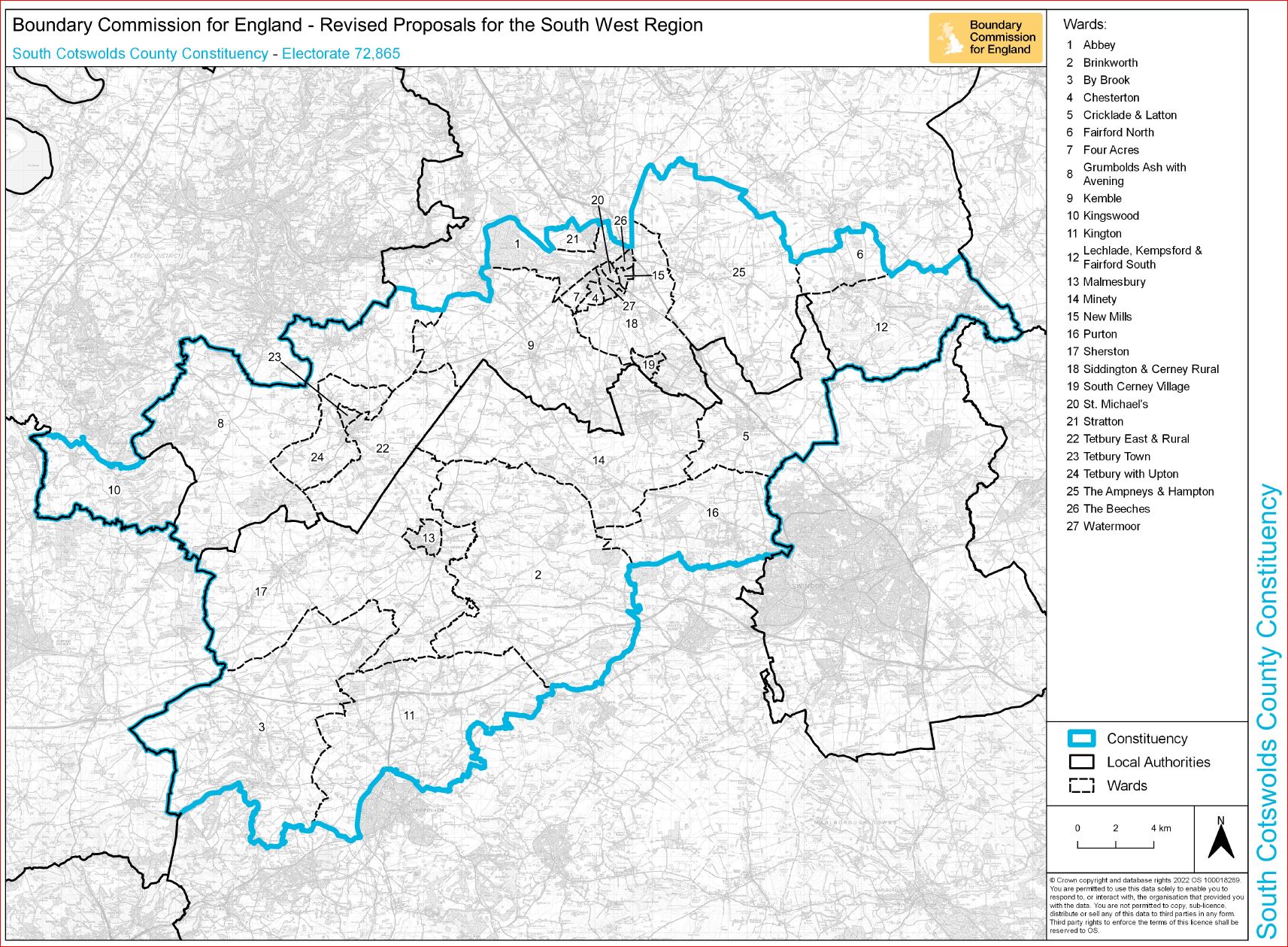
Wider Parish


Boundary Commission electoral map
Cotswold District Council
Interactive map

Biodiversity audit
2025
The Parish Council commissioned a biodiversity auditin 2025 - the report can be seen here:


© Avening Parish Council 2026

Avening Conservation
Statement 2008
Avening is a large, busy village whose character has been profoundly influenced by the exceptionally attractive valley in which it has developed. The village, which is typical of the Stroud Valleys' "cloth settlements", has grown along a complex network of roads and lanes that radiate outwards from the valley floor to climb the surrounding hillsides. The conservation area comprises the two older parts of Avening, including the landscape setting of certain parts of the village.
Avening Defence Line
Survey 2012
An HER project focusing on a section of the GHQ Line Green defence around Avening, including the tank ditch and ‘pill boxes’. The GHQ lines were static linear defences constructed under General Ironside in preparation for the expected German invasion. These lines were constructed in June 1940 but by the beginning of 1941 they were no longer regarded as being of value and large lengths fell into disuse. Written by Emma Slater MA.

Holy Cross Church -
Standing Report 2012
This Standing Building Report was produced for the main assessments of the Standing Building until as part of the Landscape Archaeology Masters at Bristol University. This report presents the results of a detailed survey of the 12th Century Holy Cross church, Avening. It is elaborating on a previous study of the Church which was produced in 2008 by Emma Slater MA. Sections of this report are currently being used on the Holy Cross website.


Parish Boundary Maps
Current and historic maps showing the Avening Parish boundary. (C) All rights reserved
Parish boundary map
Historic map


Post code map of Avening
If you need to find your way around the village, this handy post code map will help.


Listed buildings
If you need to find your way around the village, this handy post code map will help.


List view


Map view


Wider Parish
Avening
Avening is a village dating back to the Saxon period. Located in a wooded valley two miles north of the town of Tetbury, in medieval times it grew around the church and later around the mills that were built for the wool industry. The Norman Church of the Holy Cross, consecrated in 1080, replaced an earlier Saxon church, and was built at the instigation of Queen Matilda, wife of William the Conqueror. Much of the present character of Avening originated in the 17th century with the development of the cloth mills and the cottage industries connected with them. The cloth industry was a major factor in the growth of Avening until well into the 19th century, giving it an industrial rather than agricultural outlook. Avening has a population of over 1000, making it the largest village in the South Cotswolds.


Boundary Commission electoral map
Cotswold District Council
Interactive map

Biodiversity audit
2025
The Parish Council commissioned a biodiversity auditin 2025 - the report can be seen here: